Territory optimisation with road network distances
Posted 10 Aug 2014
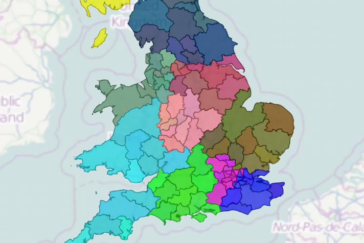
The development version of ODL Studio’s code now has support for road network distance calculation provided by the fantastic Graphhopper project. Calculating travel distances and times using a road network (instead of a straight-line crow flys) allows for more accurate modelling in logistics problems as the algorithm is aware that natural barriers like rivers or estuaries can only be crossed where a bridge exists. You can really see the difference with our automatic sales territory optimisation algorithm. In the following screenshot we have an automated territory allocation based only on straight-line distances:
[caption id=”attachment_1342” align=”alignnone” width=”400”]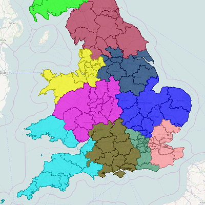 Sales territory optimisation based on straight line distances[/caption]
In the next screenshot we instead calculate travel distances using Graphhopper with OpenStreetMap providing the digital road network:
[caption id=”attachment_1343” align=”alignnone” width=”400”]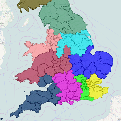 Territory optimisation with road network distances[/caption]
In the first screenshot South West Wales formed a single sales territory with Devon and Cornwall whereas in the second screenshot, only a small part of South East Wales - close to the Severn bridge - is linked to Devon and Cornwall. The territory in the second screenshot would work well for a sales person based in Bristol whereas the territory from the first screenshot is clearly unworkable. This is a classic example of garbage in garbage out - with straight line distances the algorithm is being told that South West Wales and Devon are near to each other and are thus lumped into the same territory. With more accurate input - i.e. the true travel distance between them - the algorithm gives much more sensible results.
The release of this next version of ODL Studio is imminent. Watch this space!