Step 3 - view ungeocoded records
Click here to download the complete files for all steps in this tutorial.
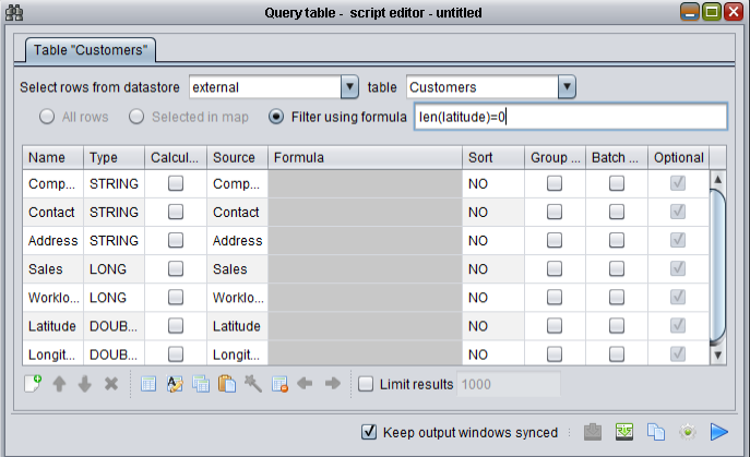
The four records which failed to geocode have incorrect format or missing postcodes. We can inspect these by running a filtered query against the Customers table. Select the Customers table, run the component wizard and select Show table (called Query table in version 1.0 of ODL Studio). Set the data adapter up as per the following screenshot, with the filter using formula checkbox ticked and the filter formula set to len(latitude)=0,

When you run this script the following table will appear:

Providing you ticked the keep output windows synced checkbox, you can then edit these four customers records using this filtered table control. You will geocode these remaining customers using interactive OpenStreetMap Nominatim geocoding in the next step.


