Territory design
Open Door Logistics studio is an open source solution for territory design, territory management and territory mapping. It can be used to manage either sales territories - where a territory defines the area covered by a single salesperson or sales team or freight delivery territories - where a territory is the area covered by a transport depot.
Benefits of optimising sales territories
Generally speaking, well-designed sales territories are balanced. No territory is too big or too small. There are many benefits to optimising your sales territories, for example:
- Travel costs can be reduced by ensuring territories are geographically compact.
- Team morale can be improved by ensuring an amicable balance of sales revenue and workload.
- Customer satisfaction can be increased by ensuring your sales team have enough time to properly cater for their customers’s needs.
Before you can balance a sales territory, you must first decide exactly what should be balanced - physical territory size, number of customers in the territory, number of customer visits, sales turnover or profit? In reality all of these factors should be considered for effective territory design, but to simply things we recommend first concentrating on two key measures - workload and total sales. Workload can be estimated based on your records of salesperson mileage and customers visits.
Benefits of optimising delivery territories
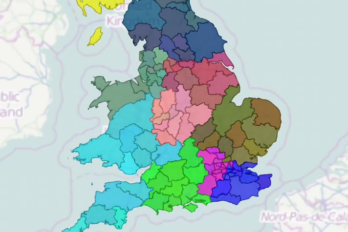
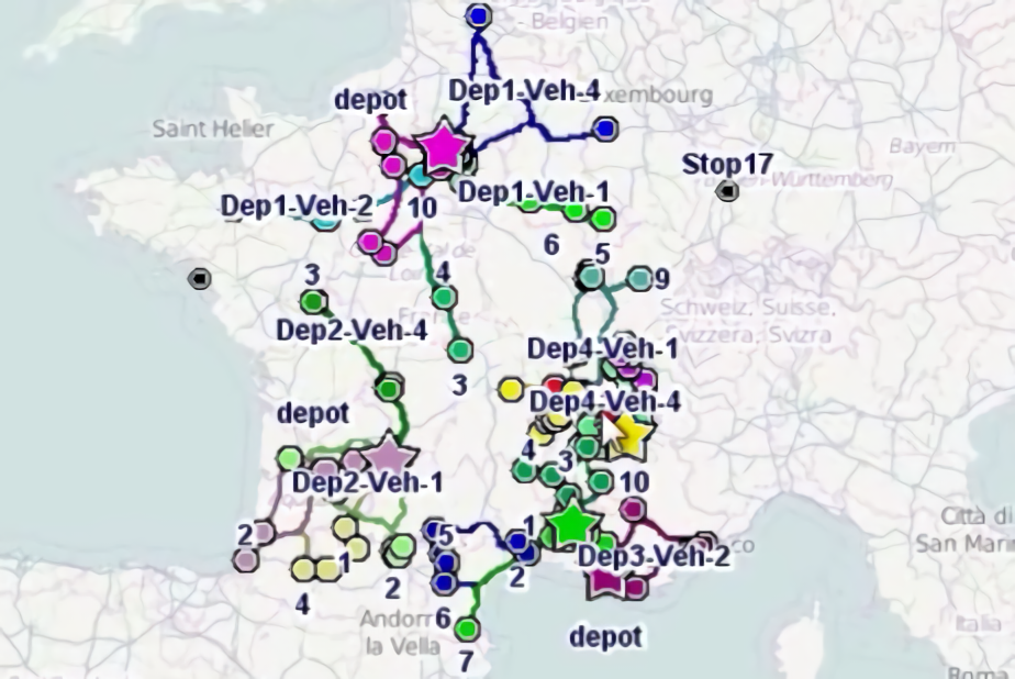
A freight delivery territory is typically the delivery or collection area served by a single depot, where multiple depots form a network which gives completely coverage of a region or country. A good example of this is pallet networks. Unlike sales territories, balance between depot territories is not a key factor. Compactness of territories - which should be validated by modelling vehicle routes - is however vital.
Territory design functionality list
- Design territories by directly assigning your customer points to a territory or aggregating to geographic building-block objects - for example states, counties, zipcode or postcode areas etc.
- Use geographic building blocks held in shapefiles - a popular format for geographic data. We provide reconstructed UK postcode building blocks suitable for territory creation.
- Use ODL Studio's data adapter functionality to aggregate statistics from customer points to building blocks.
- Visualise territories in an interactive map.
- User-defined labelling can highlight key building block statistics.
- Specify territory colour using a separate territory table or let ODL Studio automatically assign a colour.
- Use the legend control to show or hide territories.
- Design territories by simply painting them on a map, using our territory painter tool.
- Key territory statistics can be detailed in table controls or visualised using barcharts and can be set to automatically update as you paint.
- Experiment with different territory designs using undo and redo modes.
- Automatic territory designer can construct your territories in under a second using a powerful algorithm.
- Set different capacities (i.e. maximum sales or workload) per territory.
- Fix a subset of territory centres and optimise others.
- All your data is held in an Excel spreadsheet to ensure easy interoperability with other systems.