ODL Studio 1.2.0 release - new sales territory management features
Posted 06 Nov 2014
We are proud to announce the release of ODL Studio 1.2.0 - the open source software solution for sales territory alignment. This release is literally crammed full of new functionality for sales territory alignment, management and mapping, based on great feedback from our growing user base. New features include:
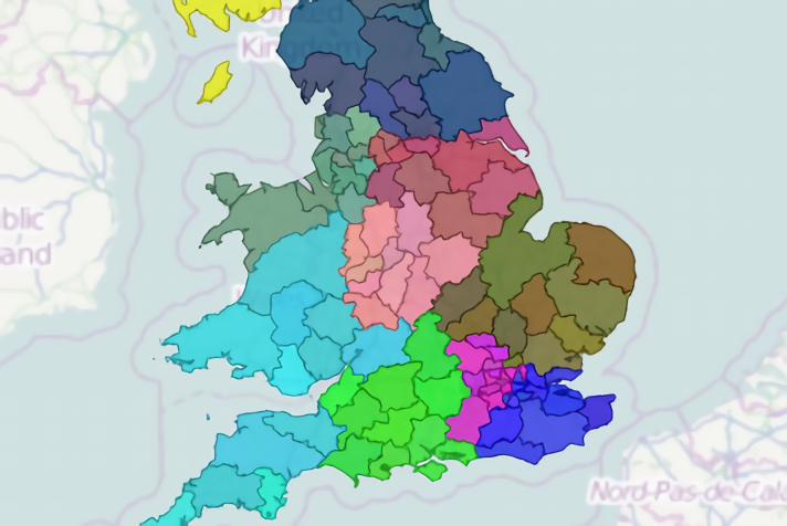
Improved mapping capabilities
- Choose different background maps by changing OSM tile servers or use a Mapsforge map
- Draw multiple layers, even when painting territories
- Compare old and new alignments by displaying borders of old alignment over your territory map
- Display borders of parent territory when using a territory hierarchy
- Display symbols marking territory centre, weighted by custom fields (e.g. sales)
- Faster map drawing
- New .odlrg file format lets you draw 1 GB of USA zipcode data!
- Quicker label drawing
Improved usability
- Better support for editing multi-option scripts
- Drop-down list of territory ids to speed up territory painting mode
- Improved support for hierarchical territory design. Make territories out of territories!
- Multi-level filter control on barcharts to support drilling-down into the data
Shapefile exporter
Export your new territories to shapefiles for easy use in other GIS applications
New formulae
- Faster filter queries for dealing with large data
- Formulae to merge your territory bricks into a single territory polygon
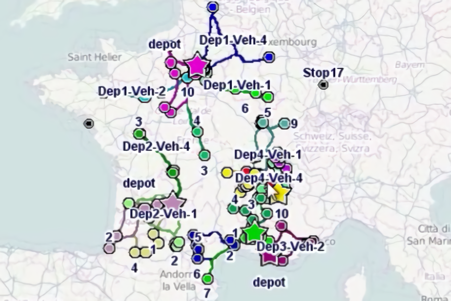
- Road network distance and time formulae - show drivetime tables!
- And many others....